Corona Launches GeoHub To Improve Community Services

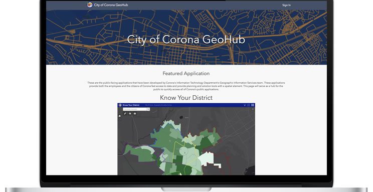
Corona, CA – The City of Corona’s Information Technology Department GIS Team, CorGIS, is pleased to announce its new GIS open data Geohub. In a continued effort to make data more easily available, the GeoHub was developed as a website where residents can explore and download our publicly available GIS data and utilize popular mapping applications.
Viewers will find links to popular applications including our Property Information Map and the Current Projects Application at www.CoronaCA.gov/GIS. The GeoHub will highlight new GIS applications and storymaps as they are continually developed by the CorGIS team.
One of the newest applications on the GeoHub is the Know Your District map which allows the public to learn more about the area they live in, including demographics and voter registration data for Corona’s voting districts, just in time for our first district elections in Corona this fall.
If you would like to learn more about GIS resources available to the public, or if you have suggestions on how to improve our services, please e-mail GISFeedback@CoronaCA.gov
About the City of Corona: Corona is located adjacent to Orange County California at the junction of the 91 and 15 freeways with a population of more than 160,000 residents. For more information regarding the City of Corona visit www.CoronaCA.gov.


